 Miguel Manning, MGIS Sales & Product Expert


1 min read
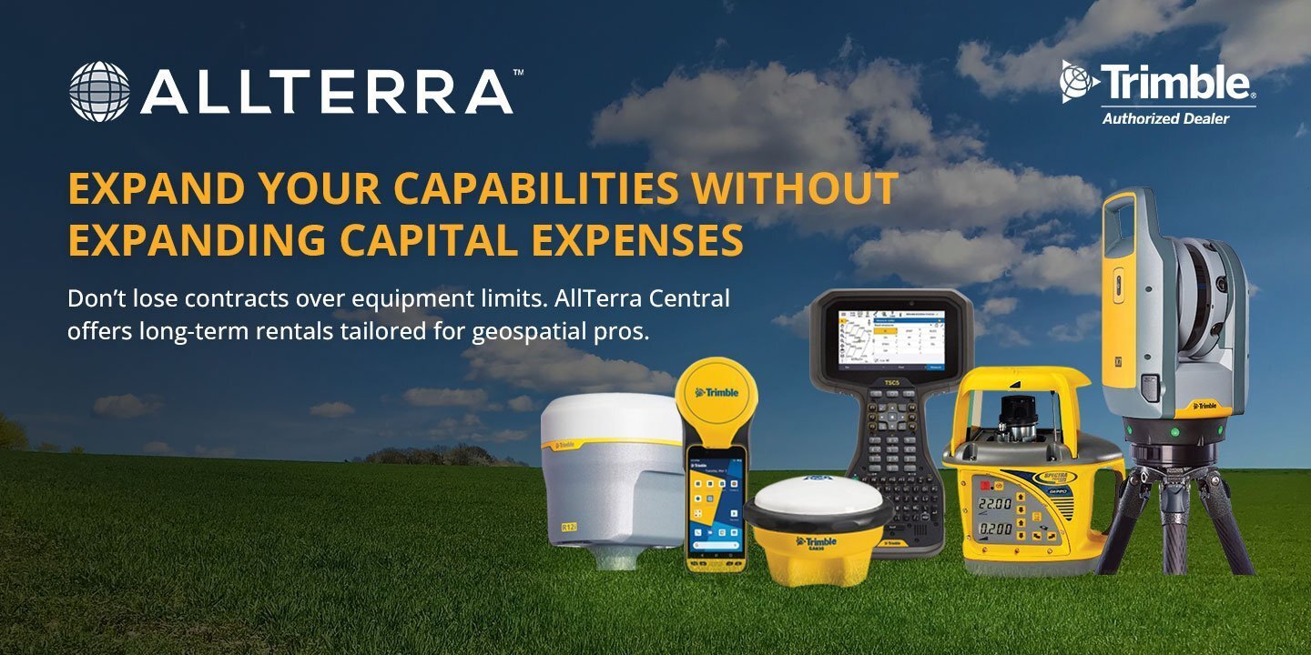
Beyond Features: Choosing the Best Mapping and GIS Hardware
Which Mapping and GIS (MGIS) Platform is right for you?
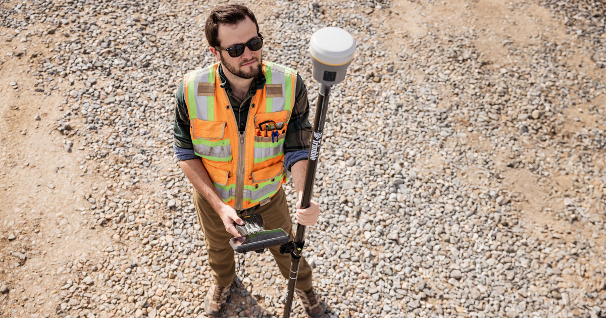
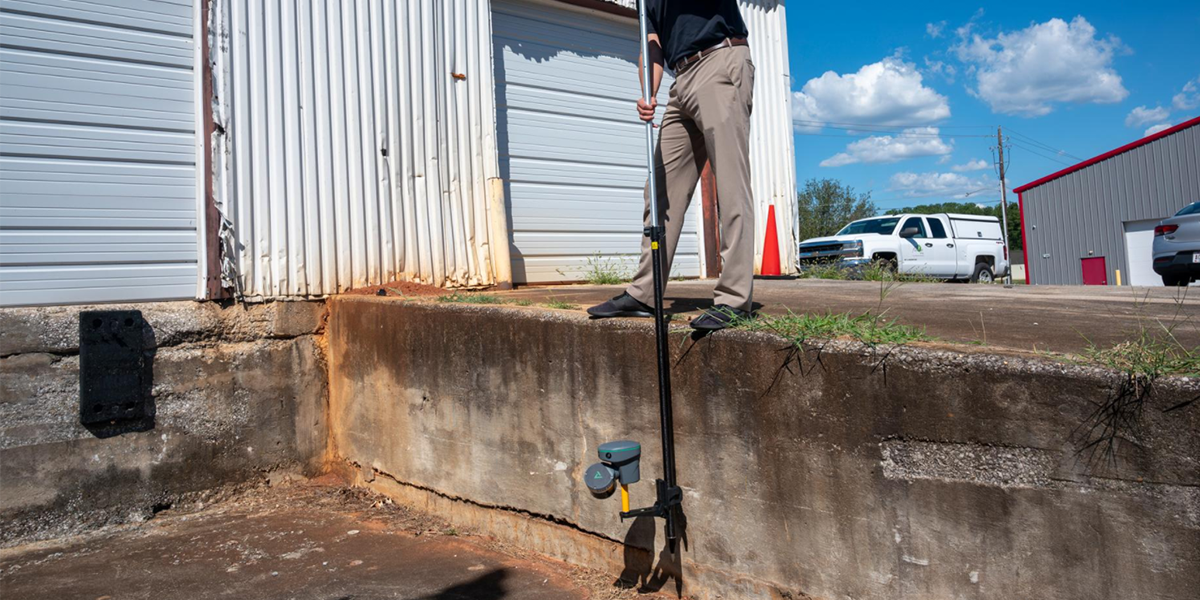
There’s no better way to see the value of field technology than by putting it to work in your own environment. That’s why AllTerra Central is excited to introduce our new “Demo in a Box” program — giving you the chance to experience Trimble and Juniper Systems Mapping & GIS solutions for three days at no cost.
Whether you’re managing assets, collecting field data, mapping utilities, or verifying construction as-builts, this program lets you test drive the technology that powers modern field workflows — right where you work.
Each Demo in a Box kit is preconfigured and ready to go, typically including:
Choose from Trimble or Juniper Systems GNSS receivers for high-accuracy positioning
Choose Trimble TDC6 or Juniper Systems Archer 4 Data Collector built for rugged, reliable data collection
Preloaded software and workflows so you can start collecting data in minutes
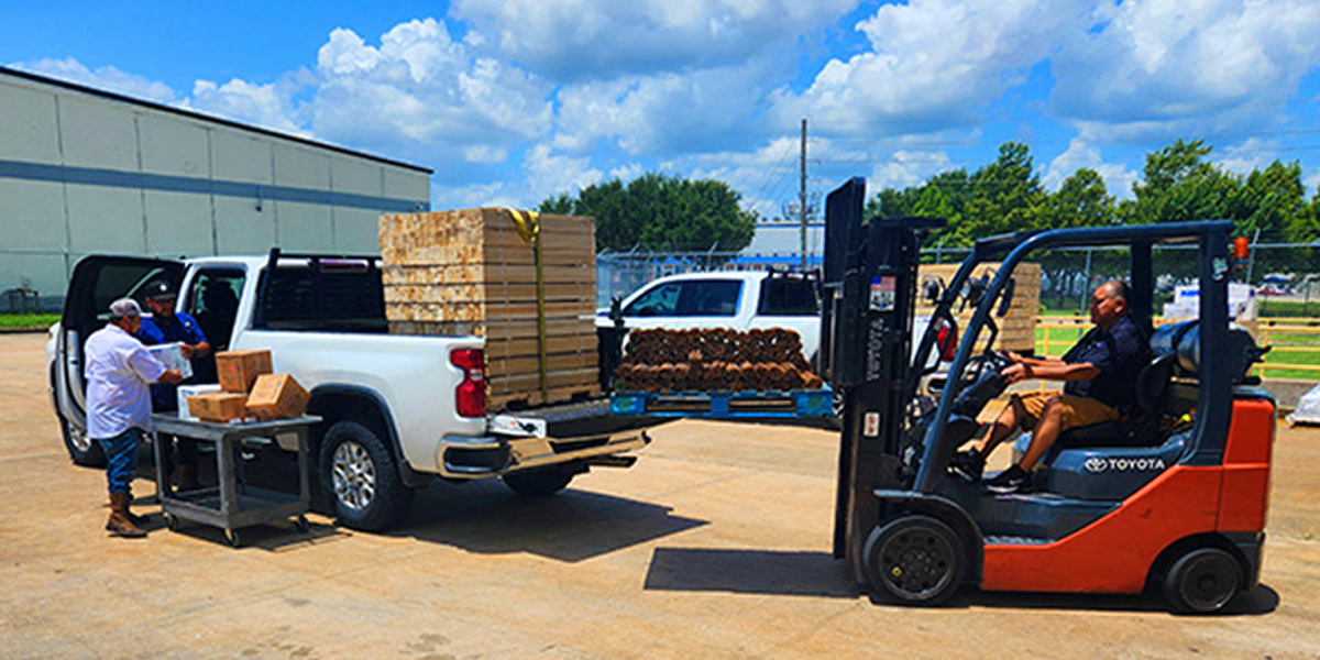
You’ll receive step-by-step setup instructions and a return label, making it simple from start to finish.
Real-world experience: See how Trimble precision and Juniper durability perform in your actual workflows.
No risk, no cost: Keep the equipment for three days — shipping both ways is on us.
Hands-on learning: Discover how easy it is to integrate accurate GNSS data with your GIS or asset management workflows.
With Trimble’s industry-leading positioning technology or Juniper’s field-proven hardware, you’ll quickly see how these tools can streamline your projects and improve data quality — whether in the field or back in the office.
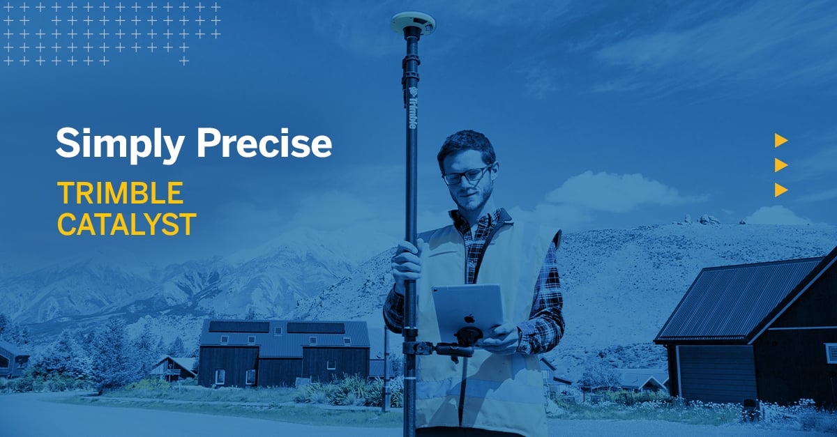
Trimble DA2 Overview
The Trimble DA2 Catalyst offers unmatched flexibility by letting you tailor accuracy levels to each project’s needs. Instead of committing to one fixed correction tier, you can choose and “stack” accuracy levels — from meter, sub-meter, decimeter, down to centimeter precision — depending on the workflow. This makes it ideal for teams managing multiple projects with varying accuracy requirements. Whether you’re doing quick asset mapping or high-precision survey-grade work, Catalyst’s subscription model ensures you only pay for the accuracy you need, when you need it.
How It Works with Subscriptions
The DA2 is hardware-enabled but software-licensed, meaning its full accuracy and functionality come from an active Catalyst subscription.
🔑 Key Components:
Subscription Tiers & Accuracy Levels
|
Subscription Tier |
Approx. Accuracy |
|
Catalyst 60 |
~60 cm |
|
Catalyst 30 |
~30 cm |
|
Catalyst 10 |
~10 cm |
|
Catalyst 1 |
~1 cm (RTK) |
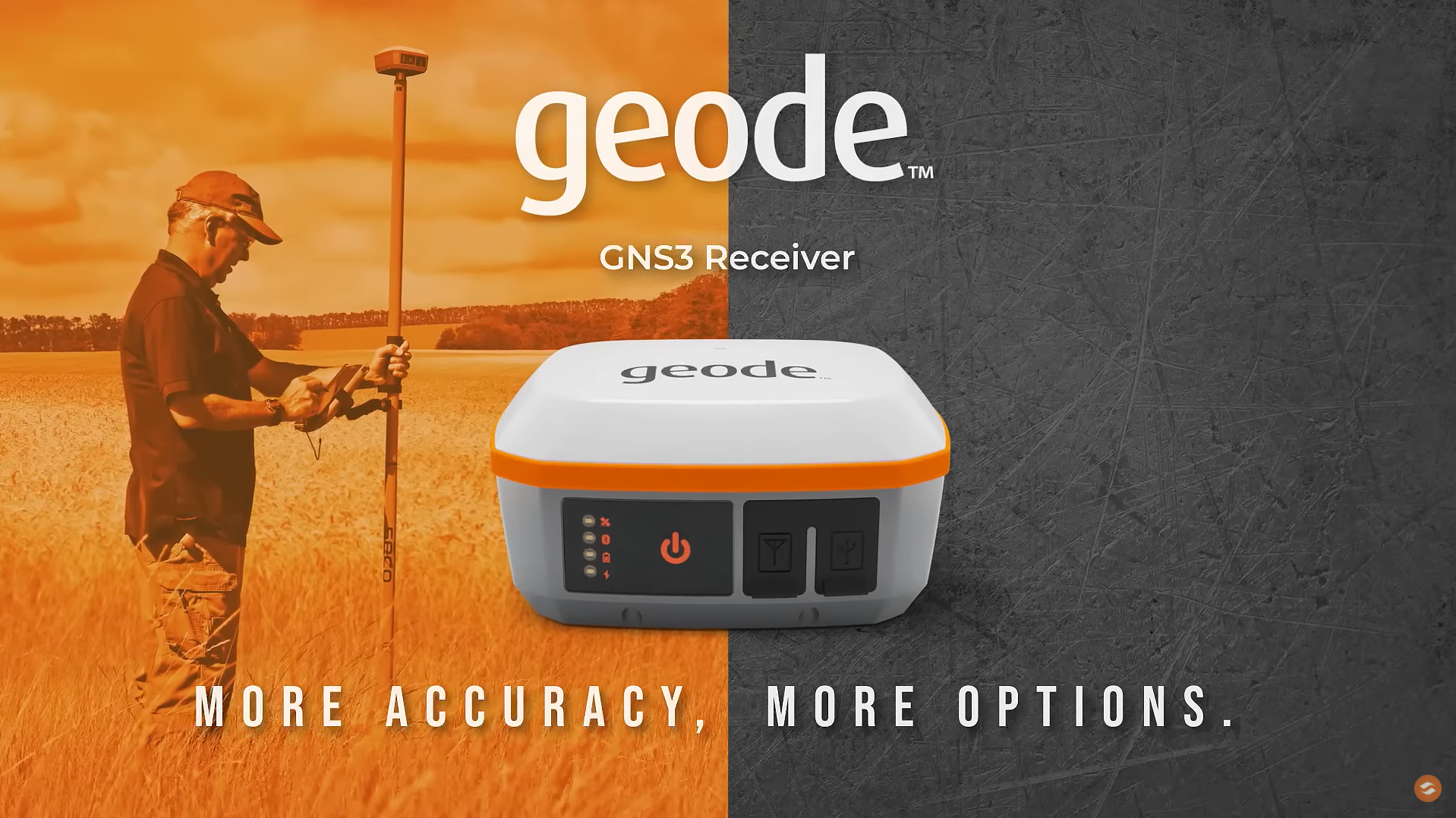
🌐 Juniper Systems Geode + Geode Grip Overview
The Juniper Systems Geode stands out for its simplicity, reliability, and no-subscription ownership model. It delivers professional-grade accuracy without requiring logins, licenses, or ongoing fees — just turn it on, connect, and start collecting data. Built for real field conditions, the Geode is rugged, weatherproof, and easy to use, making it ideal for crews who need dependable performance day after day. With support for free correction sources like SBAS and Galileo HAS (on the GNS3H), it provides consistent sub-meter to decimeter accuracy — all with no recurring costs and no complexity.
🔵 Geode GNSS Receiver (GNS3 Series)
✋ Geode Grip
📋 Key Differences from Trimble DA2
|
Feature |
Juniper Geode |
Trimble DA2 |
|
Upfront Cost |
Higher |
Lower |
|
Recurring Costs |
None (unless optional RTK/Atlas) |
Requires annual subscription |
|
Accuracy |
Sub-meter standard, decimeter with Galileo HAS or Atlas, higher with RTK |
60 cm – 1 cm based on subscription |
|
Correction Sources |
SBAS, Galileo HAS (GNS3H), optional Atlas, RTK Network |
Trimble Corrections Hub (subscription), RTK |
|
Device Compatibility |
Android, Windows, iOS (GNS3) |
Android, iOS, and Windows |
|
Ease of Use |
Simple, rugged, no login needed |
Requires Trimble ID, Catalyst app |
|
Ownership Model |
Buy once, own forever |
Hardware + subscription combo |
🌍 Juniper Systems Archer 4 + GNSS Expansion Pod
The Archer 4 is Juniper Systems’ toughest handheld yet — and when you snap on the GNSS Expansion Pod, you get a compact, high-accuracy mapping powerhouse built for the most demanding fieldwork.
🛠 Core Device – Archer 4
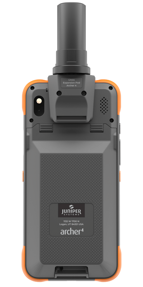
📡 GNSS Expansion Pod
💼 Perfect For
⭐ Why Choose Archer 4 + GNSS Pod?
Reserve your Demo in a Box today and experience how Trimble and Juniper Systems can transform your field data collection process.
Please click on the contact info below and reach out to Miguel or Evelyn to set up your Demo In a Box.
*You will need to have a valid rental agreement on your account, or apply for one.


1 min read
Which Mapping and GIS (MGIS) Platform is right for you?
1 min read
Tired of sacrificing accuracy for usability in GIS mapping? AllTerra Central and Trimble deliver professional-grade precision without the complexity...
1 min read
1 min read
Discover how the Trimble R980 with IBSS technology is breaking through traditional radio limitations, allowing surveyors to tackle projects of any...

1 min read
Introduction In my 15+ years managing AllTerra Central's service department, I've seen thousands of precision instruments come through our doors for...
1 min read
Imagine completing in minutes what once took hours, capturing spaces you never could before, and doing it all with a device that fits in your hand.
1 min read
1 min read
3D scanning has rapidly evolved from a specialized technique into an essential part of modern surveying and engineering. Whether you’re capturing...
1 min read
Surveying in rugged terrain is never easy. Whether it’s steep banks, dense vegetation, active mines, or remote corridors, traditional surveying...