 Billy Musick, PLS
1 min read
Rent or Buy a 3D Scanner? Make an Informed Choice in 2025
The traditional mindset of "ownership = success" is being challenged by forward-thinking survey firms discovering the strategic advantages of 3D...
Land surveyors are discovering that the biggest barrier to 3D scanning wasn't the technology—it was waiting for someone to actually make it easy...
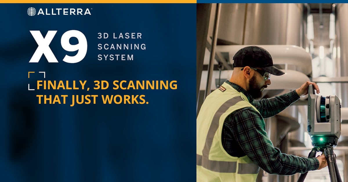
Data shows 3D scanning reduces fieldwork time by 50-70% and project costs by 5-7%, but only if it's actually easy to implement. The Trimble X9 eliminates every barrier that's kept surveyors from adopting scanning technology.
The X9's automatic calibration is a genuine breakthrough—it performs full angular and distance corrections automatically before each scan, with no targets or user interaction required. This isn't just convenient; it eliminates the traditional need for annual service calibrations entirely as well as the associated downtime.
 What this means for your crews:
 No sending your scanner away for annual service calibrations *
No 3+ weeks of downtime per year while your equipment is in service
No wondering if your data meets accuracy requirements between service visits
Consistent, survey-grade accuracy guaranteed over the scanner's lifetime*
Traditional scanners cost an average of about $20K+ in calibration services over 5 years, plus lost revenue from downtime.
The X9's smart calibration system monitors environmental conditions and applies corrections automatically, ensuring reliable data from scan 1 through 1000+.
*with normal use & adherence to best practices; calibrations can be performed as part of preventative maintenance
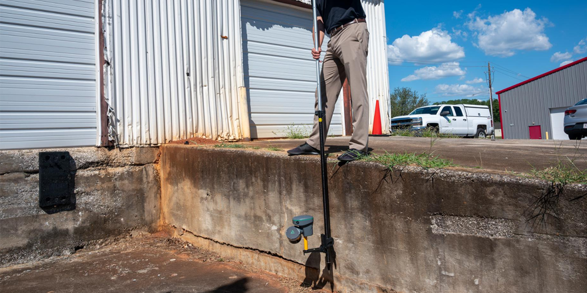
"Will it actually work in challenging environments?" The X9's IP55 rating handles dust, moisture, and weather. Its high-sensitivity EDM captures dark surfaces (asphalt) and highly reflective materials (stainless steel) that challenge other scanners.
At only 13 pounds, it's genuinely portable for difficult site access. The integrated 10 MP HDR cameras capture professional imagery in challenging lighting conditions—giving you complete documentation in a single setup.


The X9's ±10° self-leveling range (widest in the industry) with LED guidance means setup anywhere, on any surface. Whether working on uneven terrain, in cramped spaces, or even inverted mounting situations, the X9 delivers survey-grade accuracy.
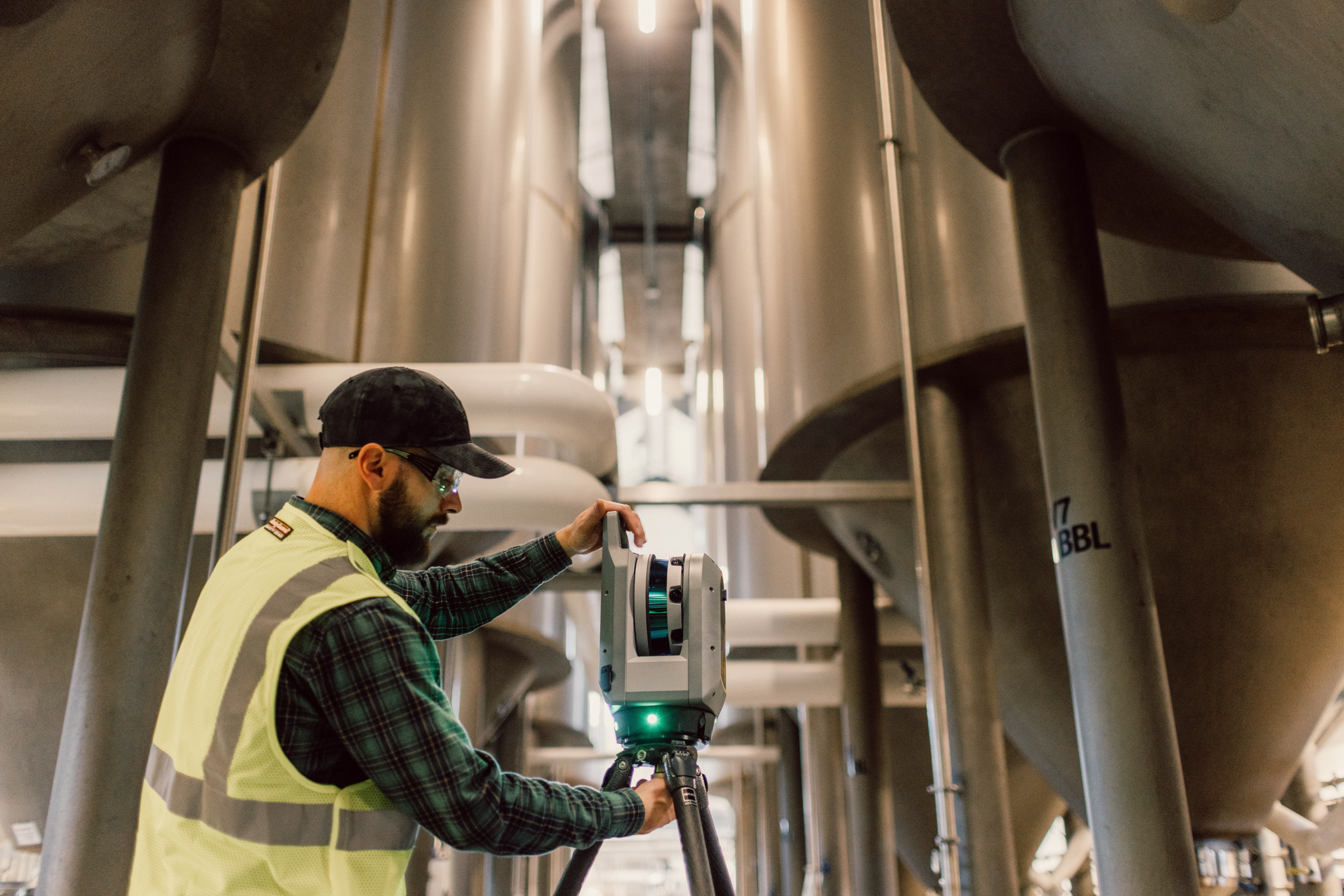
In-field registration with Trimble Perspective software provides automatic scan alignment and immediate validation. No more hoping your scans worked—you know they're perfect before leaving the site. Generate professional reports instantly for client delivery or QA documentation.
Real impact: Eliminate costly return trips for additional data collection and deliver verified results the same day.
"What's the real ROI?" Industry data shows 3D scanning reduces project costs by 5-7% and schedules by 10-12% through efficiency gains. The X9's 50-70% reduction in fieldwork time means your crews complete more projects with better accuracy.
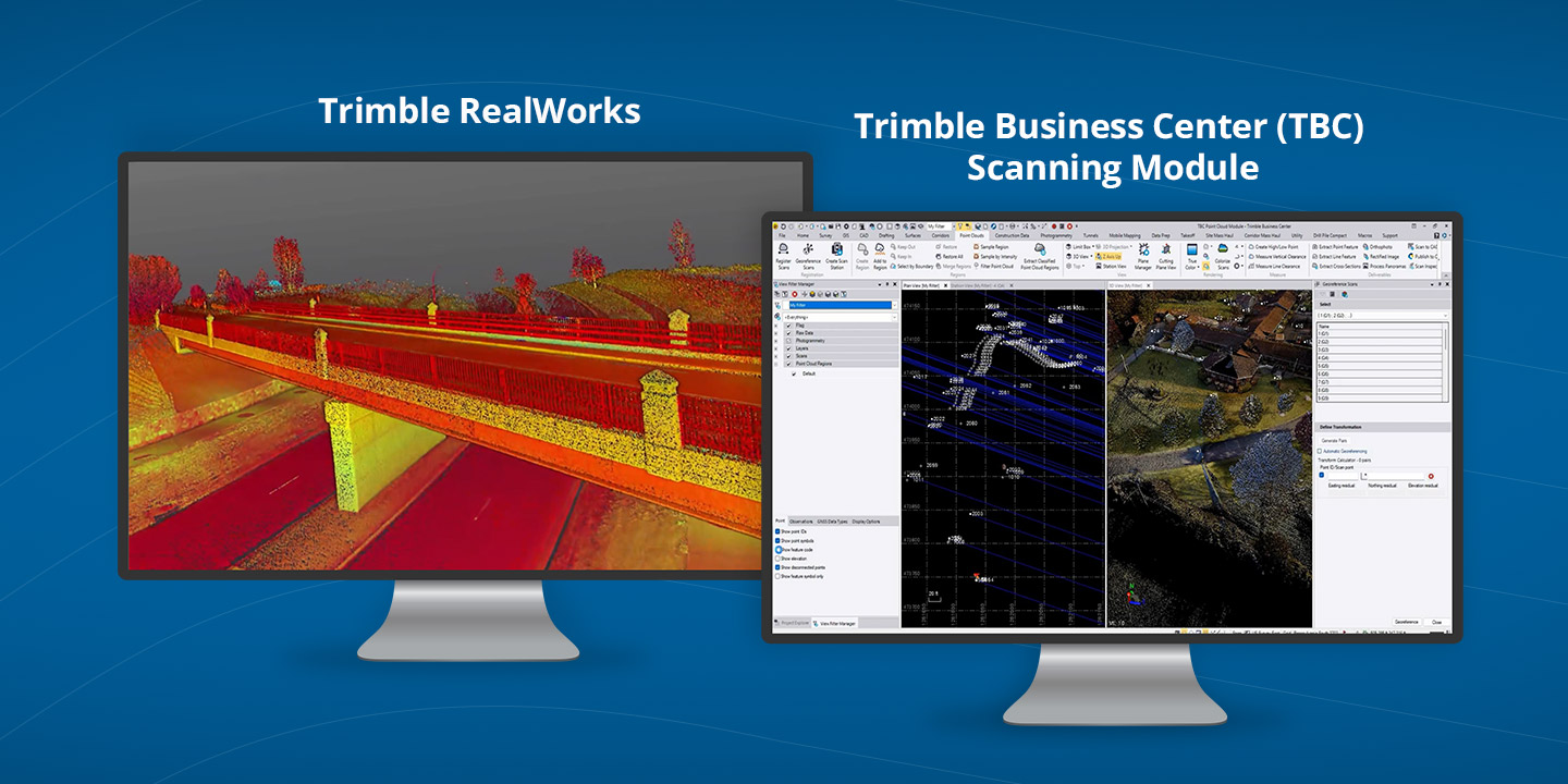
"How does this handle integration challenges?" The X9 works with your existing tech stack. It integrates with Trimble Business Center and RealWorks software, supports BIM workflows for architecture projects, integrates with drone data for comprehensive site documentation, and exports to all standard surveying software formats.
Flexible licensing options are available via perpetual or subscription plans.
Or...just rent the Trimble X9 3D Scanner and see it in action.
Training concerns? AllTerra Academy provides hands-on training programs that get your team productive fast. Our support staff offer in-field training, catered to your specific needs.
Integration worries? We help you implement scanning into your existing workflows with proven guidance from professionals who understand your operations.
Cost concerns? Flexible financing options and rental programs let you start scanning without major capital investment.
Questions? Speak to a Product Expert
The X9 answers every question that's kept your firm from adopting scanning technologies in the past.
The X9 offers easy operation, trustworthy data, proven ROI, and seamless integration with existing workflows.
Your competition is already gaining the advantage. The question isn't whether to add 3D scanning—it's how quickly can you implement it with the support of AllTerra Central?
Next steps:
3D scanning is no longer the future—it's a competitive advantage today.
👉 Learn More About the Trimble X9
👉 Watch the Overview Video
1 min read
The traditional mindset of "ownership = success" is being challenged by forward-thinking survey firms discovering the strategic advantages of 3D...
1 min read
Surveying in rugged terrain is never easy. Whether it’s steep banks, dense vegetation, active mines, or remote corridors, traditional surveying...
1 min read
3D scanning has rapidly evolved from a specialized technique into an essential part of modern surveying and engineering. Whether you’re capturing...
1 min read
Imagine completing in minutes what once took hours, capturing spaces you never could before, and doing it all with a device that fits in your hand.
1 min read
How to Decide (And Why Many Firms Use Both) Choosing the right platform doesn’t have to be an all-or-nothing decision. Start by thinking through a...
1 min read
1 min read
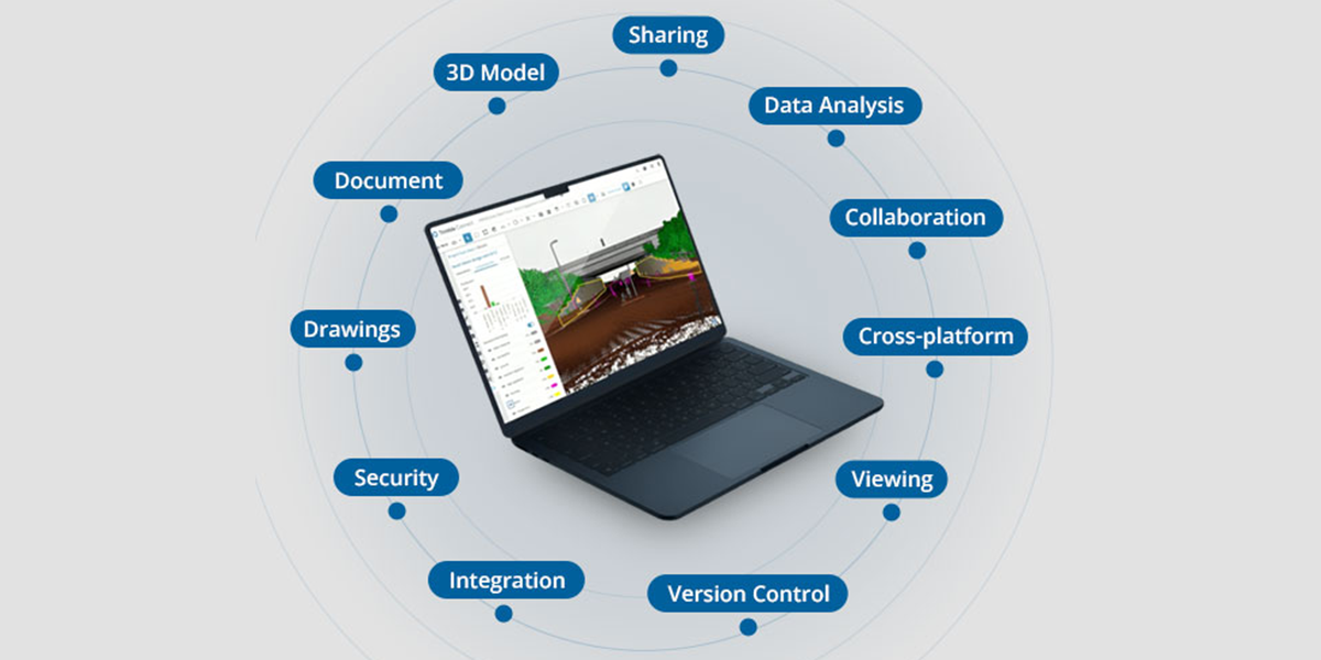
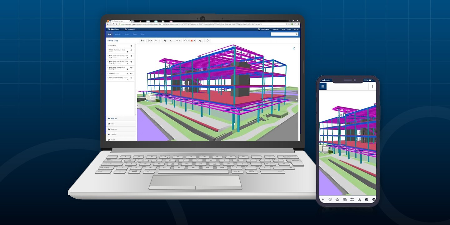
In the geospatial industry, time is quite literally money. Every minute your crew spends battling data silos, transferring files manually, or...
1 min read
Trimble Connect eliminates costly workflow disconnects by creating a unified digital ecosystem where field and office teams collaborate seamlessly,...
1 min read
After hosting a packed webinar on Trimble Connect, one thing became clear: surveying professionals are ready to move faster, work smarter, and...