WingtraRAY

NDAA Compliant.
Powerful. Tablet-based.
Welcome to 2025.

Cover up to 1400 acres in a single flight. Handle 40mph gusts. Designed for Operations Over People. All while being NDAA compliant - because your projects deserve equipment that works as hard as you do.

image-png-Jul-14-2025-07-34-16-0818-PM

Request Pricing and Demo

59
min

Flight Time

1360
acres

in One Flight

30
x

Faster than terrestrial methods

1

Really Cool Parachute

Wait, a Drone With a Parachute?

Yes, you read that right. WingtraRAY comes with an FAA-certified parachute system that automatically deploys if needed. This means that you can fly over people, building and active jobsite WITHOUT waivers or delays.

Your competition is still filling out waiver paperwork...you're already flying.

Be the First in Line to Demo

The Survey Industry is Evolving.

Ready to upgrade your survey game?

Wingtra-ray_uav

Compliance is King.

While others wait weeks for approvals, NDAA-compliant operators are winning contracts and flying freely. Your competition with compliant drones is already in the air.

Wingtra-ray_flying

Wind Doesn't Wait

40 mph wind gusts? Keep flying. When conditions ground other drones, WingtraRAY keeps your projects on schedule. Because across the USA...perfect weather is a MYTH.

Wingtra-ray_tablet-controller

Efficiency Drives Profits.

Why make 10 flights when one will do? Compare 1,400 acres per WingtraRAY flight to what you're doing now. Time is money, and you're leaving both on the table.

OOP Certified - No Waivers, No Waiting

 
Survey

98%

of US land without FAA approvals.

Legally Fly Over:

WINGTRA-RAY_UAV

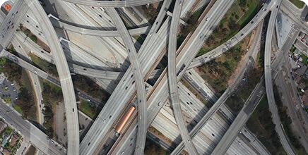
Roads & Infrastructure

 
FAA Category

3 OOP

certification.


Wingtra-ray-ndaa-compliant

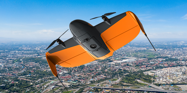
Urban & Populated Areas

I would say that you’ll start seeing an ROI immediately. I mean, this is not a consumer hobbyist drone. This is a professional, technical piece of equipment. So, just like if you have to go buy surveying equipment—that’s not cheap. I think for what you get, the Wingtra is a tremendous value compared to other high-end mapping drones.
andrew-milanes-r3divbw9rb26iznfttcxfqjvwmzz2pl5z1ipn8b05w
Andrew Milanes
President, Environmental Science Services, Inc. (Es2)
PW_250509_121648_0101 (1)
PW_250509_110234_0574
2025_WingtraRAY_front
PW_250509_151721_0120
NEW PRODUCT
WingtraRAY UAV
Contact Sales for Pricing

Product Description

WingtraRAY redefines aerial surveying by guaranteeing mission success on the very first flight—whether you’re navigating tight urban corridors or vast rural expanses—while dramatically cutting turnaround times and operational overhead. Its modular, all-in-one design scales effortlessly from millimeter-level inspections to large-area mapping, so you can serve more clients and tackle a wider range of projects with a single versatile platform.

  • Peace of mind: Confidence you’ll get it right the first time, in rural and urban environments
  • Cost Effective: The fastest most reliable way to deliver survey data
  • One tool, more jobs: Serve more customers and applications—from fine detail and mm resolution to full-scale projects—with one solution
OOP_feature-car

Fly Anywhere

You Need
  • FAA-certified parachute system - Operations over people without waivers
  • 100-meter obstacle avoidance - Focus on the data, not the flying
  • Dual telemetry (radio + LTE) - Ready for BVLOS when regulations catch up
Untitled-2

High Winds?

No Problem
  • 40 mph wind gusts - Keep working when others pack up
  • 27 mph sustained winds - Built for real-world conditions
  • All-weather reliability - From New Mexico heat to Oklahoma storms
Untitled-3-3

Your One Drone.

For Every Job
  • 1,400 acres per flight - More coverage, fewer batteries
  • Swappable sensors - From earthworks to inspections
  • All tablet-based - Draw your area and press play

WingtraRAY Technical Specifications Overview

Performance & Coverage

Maximum Coverage

550 hectares (1,360 acres) in a single flight
Using MAP61 at 120m altitude with 60% side overlap

Flight Time
  • 59 minutes - MAP61, SURVEY61, RedEdge-P
  • 45 minutes - LIDAR payload
Resolution & Accuracy

Best Resolution: 0.5 cm/pixel
Using INSPECT payload at 120m altitude

Survey-Grade Accuracy: 3 cm (0.1 ft)
Absolute accuracy (RMS x,y,z) with PPK


Aircraft Specifications

Design

Type: Tailsitter VTOL (Vertical Take-Off and Landing)
Dimensions: 125 × 68 × 12 cm (49.2 × 26.8 × 4.8 in)
Transport Case: 130 × 70 × 34 cm (51.2 × 27.6 × 13.4 in)

Flight Capabilities

Maximum Altitude: 5,000 m (16,400 ft) AMSL
With high-altitude drivetrains


Environmental Performance

Wind Resistance

Maximum Sustained Wind: 12 m/s (27 mph)
Maximum Wind Gusts: 18 m/s (40 mph)

Weather Protection

Rating: IP53
Operating Temperature: -10°C to +40°C (14°F to 104°F)
Not recommended for fog, rain, or snow


Communication & Navigation

Primary Data Link

Type: Telemetry Radio
Range: 10 km (6 mi) line of sight

Secondary Data Link

Type: LTE with Global Roaming
Range: Unlimited with network coverage

GPS Systems

Multi-constellation support:

  • GPS
  • GLONASS
  • Galileo
  • BeiDou

From Stockpiles to Subdivisions

One Drone Does it ALL

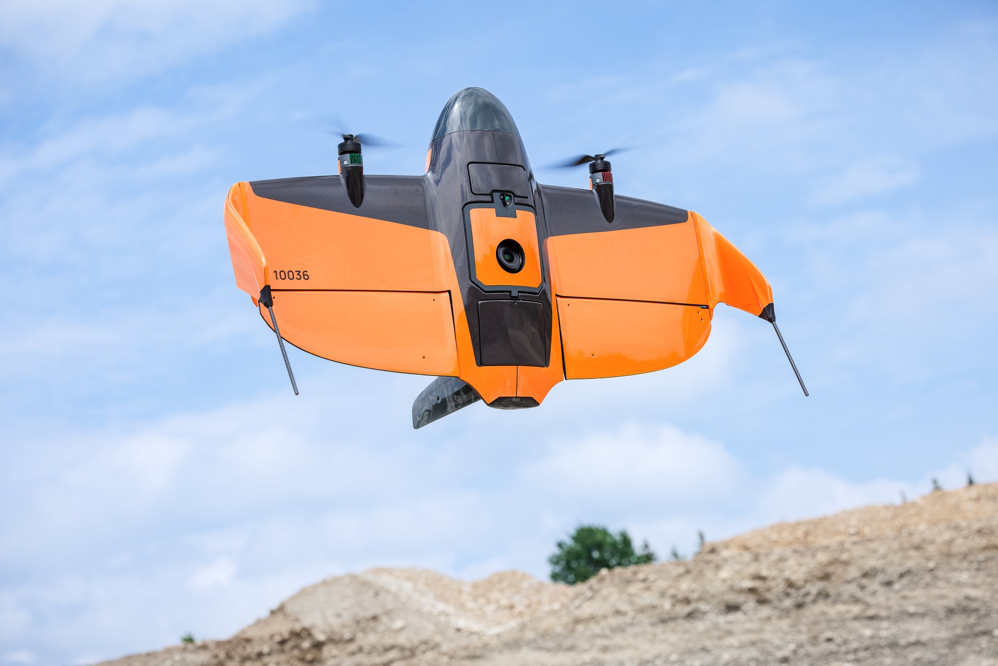
Track volumetrics daily. One flight covers your entire site. Perfect for dirt moving operations.

earthworks and stockpile

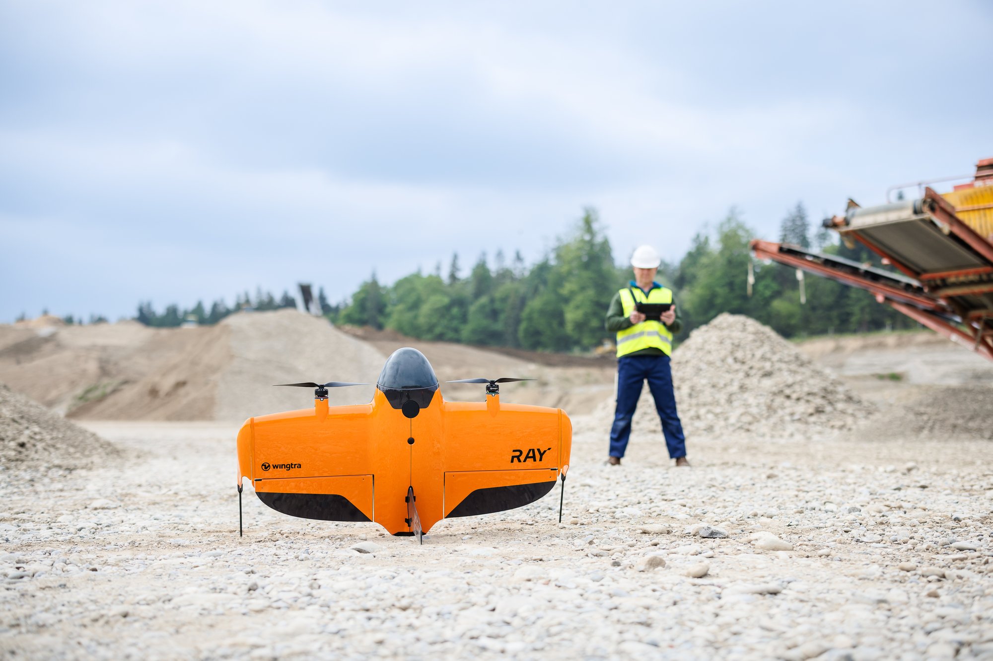
Map active construction sites without shutting down operations. The parachute has you covered.

urban-dev-wingtraRAY

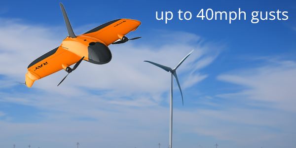
Handle dust, wind, and massive scale. Get accurate volumetrics without disrupting production.

mining jobsite

Bridge inspection at 10x the speed. Millimeter resolution when you need it.

instrastucture

Video Demonstration

PW_250509_140014_0854

Built for Real-World Survey Conditions

Because "Perfect Weather" Doesn't Exist...

Whether you're battling coastal winds, dealing with extreme temperatures, working through unpredictable weather changes, or facing challenging site conditions—WingtraRAY keeps you productive when conditions aren't perfect.

Which is basically every day in the field.

Be the First to Demo
PW_250505_165723_0129-Edit

Frequently Asked Questions

Can’t find any answer for your question?
Ask our UAV sales team

When can I see WingtraRAY in action?
Demo days will begin in August of 2025, be sure to be the first in line to see it in action.
How does the parachute system work?

Fully automatic deployment based on flight anomalies, with manual trigger backup. FAA-certified for Operations Over People—no waivers needed in 98% of US territory.

What makes it so easy to use?
No controller needed. Just use the tablet: draw your survey area and press play. Seriously, it's that simple.
Is this really better in wind?

Handles 40 mph gusts and 27 mph sustained winds. When others are grounded, you're still billing.

What about BVLOS readiness?
Dual telemetry (radio + LTE) built in. When Part 108 regulations arrive, you're already equipped.
I already use WingtraOne GEN II. Can I upgrade to WingtraRAY?

Yes. If you already use WingtraOne GEN II, you can:

  • Easily move your MAP61, RX1R II, LIDAR, or RedEdge-P sensor from WingtraOne GEN II to WingtraRAY with an affordable upgrade mount.
Are WingtraOne GEN II sensors compatible with WingtraRAY?

Yes—with an upgrade mount, you can reuse most GEN II sensors, including:

  • MAP61
  • Wingtra LIDAR
  • RedEdge-P
  • RX1R II
Can I use my own post-processing software?

Yes. WingtraRAY outputs are compatible with major third-party tools like:

  • Pix4D
  • Agisoft
  • Trimble Business Center (TBC)
  • and more
What Outputs do I Get?

Once WingtraRAY data is processed in WingtraCLOUD, you can export:

  • Orthomosaic (.GeoTIFF)
  • Point cloud (.LAS or .CSV)
  • Digital surface model (DSM) (.GeoTIFF)
Is WingtraRAY approved by the FAA for operations over people (OOP)?

WingtraRAY is on track for FAA approval to fly over people and moving vehicles without a waiver. While formal approval is still pending, the FAA has accepted our proposed Means of Compliance, and WingtraRAY has passed all required tests.


Look, This Is Simple

Real talk from UAV Sales Manager, Chris Mauldin

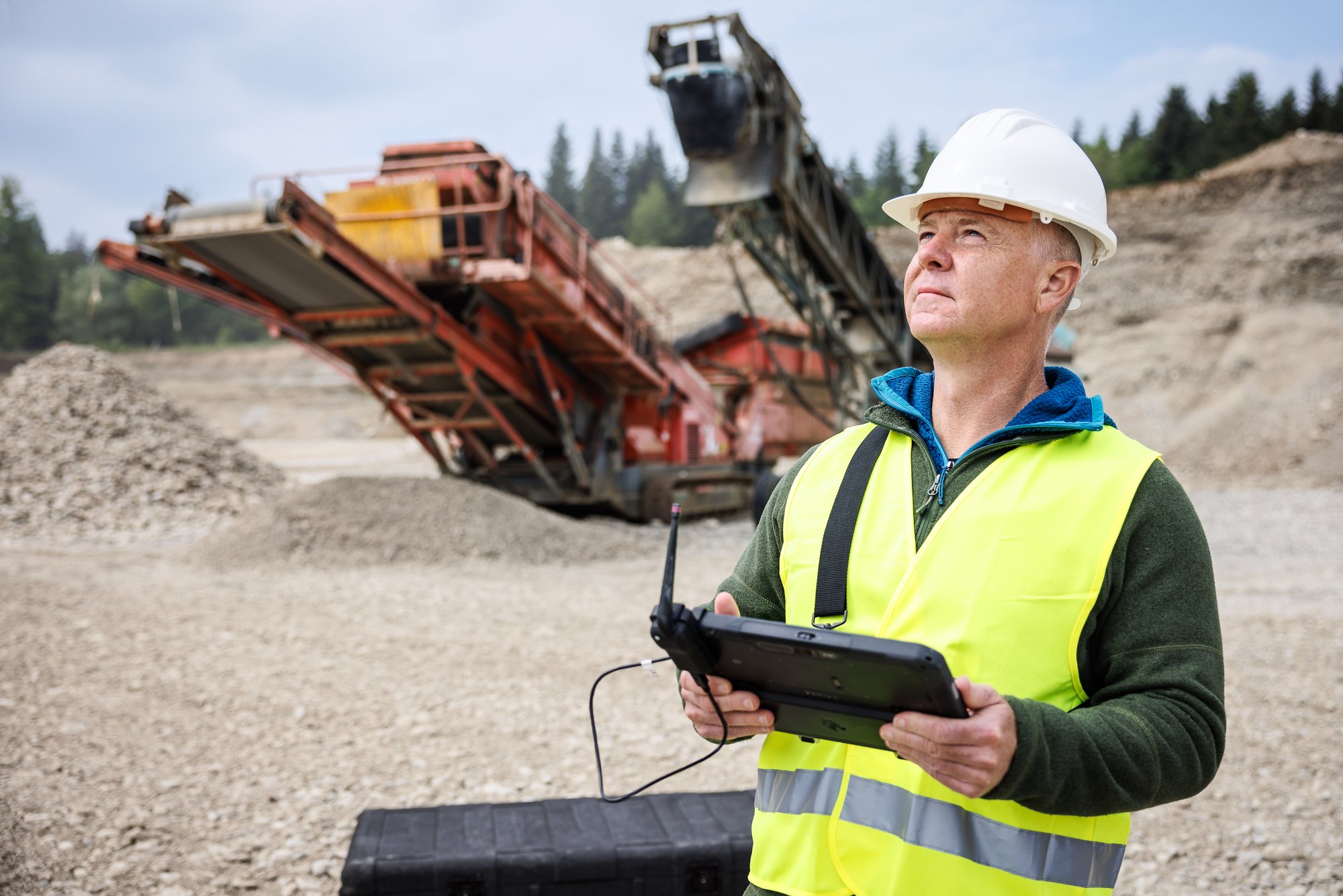
"Here's what matters: It's easy to use. It handles wind, really well! It covers more ground than anything else. And best of all? It's NDAA compliant—so you can actually use it on the projects that pay.

Stop losing money waiting for waivers. Stop packing up when the wind picks up. Stop making 10 flights when one will do.

This is the drone that actually works for surveyors. Because it was built by people who understand what you deal with every day."

Be the first to demo
Untitled-8